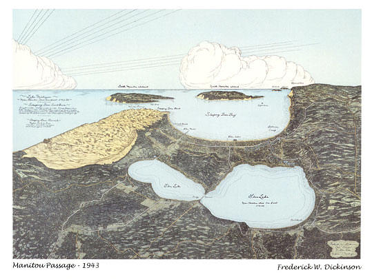
Dickinson Photo Gallery on Glen Lake, Sleeping Bear Dunes, Glen Arbor, Leelanau County Michigan Dickinson Photo Gallery, Glen Lake Michigan, Sleeping Bear Dunes National Lakeshore Park, Glen Arbor, Leelanau County Michigan  
Gallery 1
Gallery 2
Postcards
Maps
Storefront
Location
Family History
Area History
Home
E-Mail Us


Historical Maps

(click to enlarge)      
map of Glen Lake area, printed 1943, Rand McNally Co.    Glen Lake area map, drawn by Frederick W. Dickinson. A collector's treasure, this map is part of the original printing in 1943, by the Rand McNally Co. in Chicago. The map is printed on heavy stock and measures 27 and one half  inches by 37 and one half inches and is signed by the artist.  $175.00.  
    Purchase by Phone (231-334-6800) or E-mail  


Gallery 1   Gallery 2   Postcards   Maps     Storefront   Gallery Location
 Family History     Area History     Home


Dickinson Photo Gallery
7611 W. Glenmere Rd.      Empire MI. 49630    231-334-6800   E-Mail us
est. 1938    3,1/2 miles south of Glen Arbor

 
    site last updated: April, 2006


 ©2006, Dickinson Photo Gallery. Reproduction by any means, physical or electronic,
 in part or in full, without permission is strictly prohibited.
webmaster: Joanne